Podobni Video posnetki:
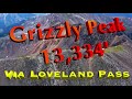 | Grizzly Peak, prijazni pohod do 13.334' prek Loveland Pass, CO Kinematografska predstavitev
To je priročen in popoln uvodni pohod za novince in/ali zimske ture v coloradske... |
 | Prek slikovite Herman Gulch Kinematografski - Pohod Pettingell Peak in free solo Citadel
To je priročna, a EPIC gorska plezalska avantura tik ob I-70 na severu in tik vz... |
 | Pohod Crystal Peak prek lazanja grebena razreda 4, od Mt Hellen, območje Breckenridge, Colorado
To epska avantura nas popelje navzgor na Mt Hellen in čez dramatično grebensko p... |
 | Kinematografski - Vrhovi Bancrofta, Parryja in James Peaka, pohod od Loch Lomonda
To je nočitvena taborna avantura za raziskovanje lepih ledenih jezer in slapov s... |
 | Kinematografski - Veliki prehod, Gore Range, Vail CO, pohod in plezanje na visoki nadmorski višini
To avanturo nas popelje globoko v Gore Range tik vzhodno od Vaila v Koloradu za ... |
|
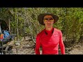
Opis:
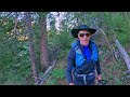
3. del mojega samostojnega prehoda proti severu po Sheltowee Trace v maju 2017.
Sheltowee Trace je 324 milj dolga pot, ki poteka (v smeri mojega pohoda) od južne končne točke pri Burnt Mill Bridge Trail Head v Big South Fork National River and Recreation Area, skozi Cumberland Falls in Red River Gorge, nato do severne končne točke za Moreheadom v Kentuckyju.
|