Podobni Video posnetki:
 | Zagorelec, Veliki Jelenk, Skutnik in Špičica 1
Zadnja Trenta, Zadnji Pelc, Bavški Grintavec, Nizki vrh, Vršič, Prisank, Trentsk... |
 | Od Jerebikovca do Trupejevega poldne 2
Julijci, Blekova planina, Špik, Ziljska dolina, Beljak, Baško jezero, Lepi vrh, ... |
 | Od Jerebikovca do Trupejevega poldne 1
Rateške Ponce, Strug, Jalovec, Kranjska Gora, Medvednjek, Vitranc, Rekaršca, Jul... |
 | Od Golice do Stola 2
Blejsko jezero, Dežela, Radovljica, Lesce, Zabreška planina, Ovčji vrh, Mačenska... |
 | Od Golice do Stola 1
Planina pod Golico, Julijci, Struška, Koča na Golici, Vajnež, Stol, Kepa, Mežakl... |
|
Opis:
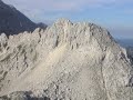
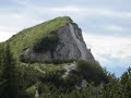
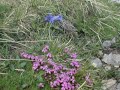
Okolica Mount Hooda je fantastična. Veliko poti, dreves, vulkanske stvari in neskončne naravne rože. Kar se začne kot poročan tek 38 milj, se spremeni v 44,5 miljsko pošast z 11.000 ft vzpona, večinoma po pumeksu. Z spominom na tek, ki mi še boli noge, se vzpenjam na višave Hooda. Večkrat so me opozorili na taljoče skale, ki se sproščajo in drvijo proti meni kot Indiana Jones, a nevarnost se ni uresničila.
|